AISPECO and Teledyne Geospatial present an innovative airborne asset management solution
AISPECO and Teledyne Geospatial solution
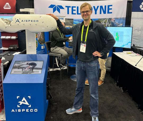
Teledyne Geospatial, in collaboration with AISPECO, exhibited the Network Surveyor solution at DISTRIBUTECH 2025, the largest and most influential transmission and distribution event in the United States. Held from March 24-27 in Dallas, Texas, the event brought together industry experts to explore the latest advancements in utility infrastructure monitoring.
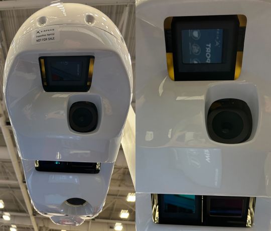
Visitors to the Teledyne Geospatial booth had the opportunity to see the Optech EchoONE UAV LiDAR payload alongside AISPECO’s HELIUX LITE and Pointerra3D’s processing engine.
- The Optech EchoONE is an affordable, high-performance NDAA compliant UAV Lidar sensor compatible with NDAA compliant UAV solutions such as the Freefly Astro Max and the Inspired Flight IF800.
- The AISPECO HELIUX LITE is a flexible sensor mounting solution designed for multiple aircraft types without requiring any modification and supports a wide variety and number of sensors including Lidar, RGB, 4-band, hyperspectral and thermal.
Designed specifically for powerline applications, Network Surveyor is the first in a series developed in collaboration with Teledyne. It integrates cutting-edge LiDAR technology with edge processing to provide near real-time insights, enabling teams to land with fully processed data that seamlessly integrates into Pointerra3D’s cloud-based engine. Its modular LiDAR design allows for adaptable scanning patterns, including Forward-Backward-Nadir configurations. The system can also be reconfigured for use with drones or assembled into a single pod for helicopter operations, ensuring flexibility, efficiency, and compliance with NERC FAC-003 regulations.
“We are thrilled to be part of DISTRIBUTECH 2025 and showcase our Network Surveyor solution,” said Matthew Johnson, Product Manager at Teledyne Optech. “Our collaboration with AISPECO and Pointerra3D delivers a complete, end-to-end solution that addresses the critical needs of the Electric Utility Vegetation Management and Asset Management functions. We look forward to demonstrating how our technology can help utilities enhance their operational efficiency and compliance.”
“AISPECO is proud to partner with one of the historical greats in surveying. Teledyne’s LiDAR scanners introduce new possibilities for our customers – some have been requesting this for a long time,” said Mantas Vaskela, CEO of AISPECO. “This partnership underscores AISPECO’s commitment to delivering the best technological solutions and our ability to integrate new capabilities seamlessly.”