What is surveying?
Introduction
Surveying is the science and technique of measuring and mapping the Earth’s surface. It helps determine the exact position, shape, angles and elevation of both natural and man-made features. This foundational data is essential for planning, designing, and constructing everything from land plots, buildings, and engineering infrastructure to public spaces, parks, and entertainment areas.
Surveying has been essential for thousands of years, driven by the need to understand land ownership, boundaries, and spatial relationships. As early as 2700 BC, ancient Egyptians used simple tools such as ropes and plumb bobs to establish straight lines and precise measurements for monumental structures like the pyramids. Over the centuries, traditional land surveying evolved through the use of instruments like compasses, chains, levels, and theodolites. These methods required a high degree of skill, observation, and manual precision. Surveyors played a vital role in defining property lines, supporting agricultural planning, and enabling the development of early infrastructure. Today, surveying combines centuries of knowledge with advanced technology to deliver precise and reliable geospatial data for modern infrastructure, environmental projects, and land development.
Why surveying is important?
Surveying is the first step in many land and construction projects. It helps us understand what’s on the ground, where things are, and how to build safely and correctly. Here are the main reasons why surveying matters:
- Measuring land – the starting point
Surveying starts by measuring plots of land. It shows where the borders are, how big the land is, and who owns it. This is very important for land registration, property sales, and solving boundary issues.
- Understanding the land
Surveyors also look at the land’s shape – like hills, slopes, rivers, and trees. This information is used in design and construction projects to make sure buildings, roads, and other structures fit the land well.
- Helping with construction
Surveying gives builders the exact positions and levels they need to follow. This makes sure things like roads, pipelines, and buildings are built in the right place and are safe and strong.
- Planning cities and protecting nature
Survey data is used in urban planning, zoning, and environmental projects. It helps cities grow in a smart way and protects natural areas by showing how people and nature interact.
- Big projects and new technologies
- Surveying is also used in:
- Forests and farming
- Mining and resource management
- Power line and railway inspections
- 3D maps and models
- Checking roads and buildings over time
- Drones and other modern tools help gather this data faster and more accurately.
- Watching for changes over time
Surveying helps track changes in the land, like erosion, flood risk, or damaged structures. This is useful for maintenance, public safety, and disaster prevention.
Surveying helps people understand, plan, and build. It makes sure every project – big or small – starts with good, clear information. Whether for property, construction, or nature, surveying keeps everything on the right track.
Main types of surveying
Different types of surveying serve different needs. Here are five of the most common:
- Land surveying
Measures and maps property boundaries, used for legal documents, land division, and construction permits. - Topographic surveying
Captures the natural and built features of an area – such as terrain, vegetation, roads, and buildings – used in planning and environmental analysis. - Engineering surveying
Provides data for the design and construction of infrastructure like highways, tunnels, building, railways, and utility networks. - Aerial and drone surveying
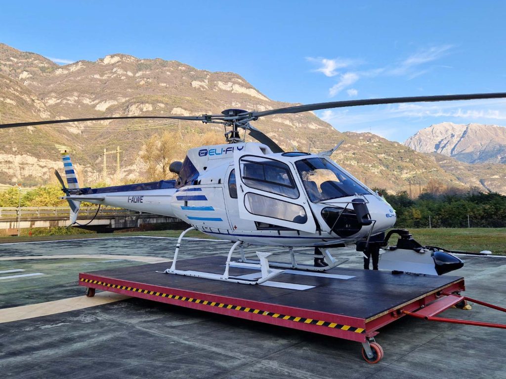
Uses drones or aircraft to collect data over large or difficult-to-access areas. Ideal for mapping, agriculture, and utility inspections.


- Hydrographic surveying
Measures underwater features such as riverbeds, lakes, and coastlines. Crucial for marine construction, navigation, and environmental protection.
Each type of surveying plays a unique role in helping professionals understand and manage the physical world. Whether measuring land boundaries, analyzing terrain, or mapping the ocean coastline floor, these surveying methods provide the precise data needed for informed planning, design, and development. Choosing the right type of survey ensures the success and safety of any project.
Common surveying tools and technologies
Surveyors use a mix of traditional instruments and modern systems depending on the project’s needs:
- Total stations – Combine angle and distance measurement, commonly used on construction sites or where precise GNSS/GPS surveys are not possible.
- GNSS/GPS – Satellite-based positioning for mapping open areas with high accuracy.
- Drones (UAVs) – Equipped with cameras or LiDAR for aerial surveys,3D modelling, building construction sites monitoring, mining, local objectsof power lines or pipelines inspections.
- LiDAR (Light detection and ranging) – Laser scanning technology that creates detailed extremely precise 3D surface, buildings or corridor models.
- Photogrammetry – Creates maps and models from overlapping photographs.
- Traditional tools – Such as, measuring tapes, plumb bobs, and levels, still used for basic or short-distance measurements.
Modern surveying relies on a combination of time-tested tools and technology to deliver precise and efficient results. The choice of equipment depends on the project’s scale, location, and required level of detail. By leveraging the right tools, surveyors can collect accurate data faster, improve safety, and ensure better outcomes across a wide range of applications.
Where Is surveying used?
Surveying plays a crucial role in a wide range of industries. Some of the key applications include:
- Land measurements – ensures of cadastrial data collection
- Construction & civil engineering – Ensures accurate construction of buildings, roads, and infrastructure.
- Urban planning & land development – Helps with zoning, and infrastructure planning.
- Utility projects – Aids in the inspection and maintenance of powerlines, pipelines, and railways.
- Environmental monitoring – Tracks changes in landscapes, water levels, and ecosystems.
- Real estate & legal boundaries – Defines property lines, resolves disputes, and ensures legal compliance.
In conclusion, surveying is integral to effective planning, construction, and management across many sectors, providing the foundational data required for safe, efficient, and informed decision-making.
Conclusion
Surveying is the foundation of smart, safe, and sustainable development. From ancient monuments to modern infrastructure, accurate geospatial data ensures that every project starts with a clear understanding of the land.
As tools continue to evolve – from traditional instruments to advanced drones and LiDAR – surveying remains essential to planning, construction, environmental protection, and more. By investing in high-quality surveying, organizations can reduce risks, improve efficiency, and make better-informed decisions.

