McKim & Creed Expands Geospatial Capabilities With Cutting-Edge AISPECO Equipment Acquisition
RALEIGH, N.C. – January 20, 2026 – As client demand continues to grow for faster, higher-resolution geospatial insights, McKim & Creed has expanded its aerial data collection capabilities with the acquisition of the AISPECO multi-sensor pod system, integrated with a RIEGL LiDAR sensor and a Phase One camera. This strategic investment scales the firm’s well-established geospatial services by supporting higher-density data capture, shorter delivery timelines, and consistently exceptional accuracy.
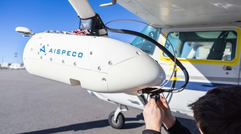
AISPECO Heliux LITE pod system
Implemented in partnership with Vertical Aspect, the solution features the Heliux LITE, a modular, AI-powered system designed for versatile, high-precision data collection across a wide range of applications including corridor mapping, wide-area surveys, utilities inspection, forestry, and more.
“Our investment in AISPECO’s technology is about scaling our ability to deliver high-resolution, accurate data faster and more efficiently than ever,” said David Jones, Senior Vice President of Geomatics at McKim & Creed. “With mounting pressure on timelines and demand for precision across sectors, this equipment and our team of experts allow us to stay ahead while serving our clients with greater agility,” Jones said.
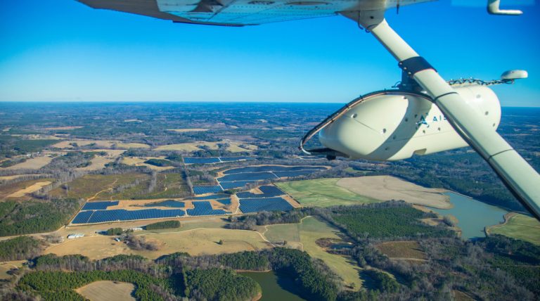
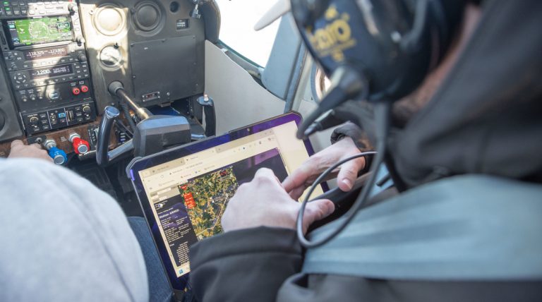
The HELIUX pod systems are designed for both helicopters and light aircraft, requiring no permanent modifications to the airframes. With plug-and-play modularity, the systems support up to nine sensors including lidar, hyperspectral, thermal, and optical payloads. The inclusion of AISPECO Heliux CORE enables AI-assisted control, real-time QA, and seamless integration across data streams.
“This new equipment offers our team more operational capacity,” added Matt LaLuzerne, Director of Geospatial at McKim & Creed. “We can now collect higher volumes of quality data in fewer flights, optimize project logistics, and support more concurrent projects across our geographic footprint. It directly strengthens our backlog delivery and increases value to our clients.”
AISPECO’s platforms are already trusted in sectors ranging from power utilities and transportation to environmental monitoring and defense. With this acquisition, McKim & Creed is positioning itself at the forefront of aerial surveying and geospatial intelligence.
About McKim & Creed:
McKim & Creed is an award-winning, employee-owned civil engineering firm operating in North Carolina, South Carolina, Virginia, Pennsylvania, Delaware, Ohio, Florida, Georgia Louisiana, and Texas. McKim & Creed specializes in services for the energy, transportation, federal, land development, water and building markets, including survey and mapping; airborne and mobile lidar/scanning; unmanned aerial systems (UAS); subsurface utility engineering (SUE); and hydrographic and conventional surveying; water and wastewater, MEP, fire protection and structural engineering; and industrial design-build. For more information about McKim & Creed, visit www.mckimcreed.com.
About Vertical Aspect
Based in Kansas City, Mo., Vertical Aspect delivers cutting-edge remote sensing, lidar, automation, and drone-based mapping technologies designed to solve complex spatial challenges for industries including land surveying, utilities, transportation departments, construction, and remote sensing.